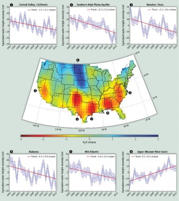
Satellite Data Shows U.S. Water Hotspots
by Brett Walton
Scientists who use the GRACE satellite say they need more resources to maximize its usefulness for predicting floods and droughts.
New data from a pair of satellites that have changed the practice of water measurement show significant fluctuations since 2003 in the water reserves of six areas of the United States.
These "hotspots" include some of the fastest growing regions of the U.S., some of its most important farmland, and some areas not typically considered water-scarce.